Punxsutawney Phil popped his head out this morning and didn’t see his shadow, which Groundhog Day legend means the country is in for an early spring.

It’s anything but spring-like right now in Lake Tahoe, which is in its third straight day of snow. And following a likely snowless day Saturday (Feb. 3), the white stuff is expected to return for the next six days. That’s good news for Tahoe ski resorts, which have been below their annual snow totals all season long.
CHECK OUT TAHOE SNOW REPORT BELOW
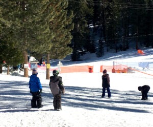
Granlibakken Resort, a family-friendly ski and snow play area in Tahoe City, saw a modest two-day total of 4 inches of snow in the past 48 hours, but is expecting much more in the coming days.
“Despite Punxsutawney Phil not seeing his shadow this morning, we are trusting that the recent heightened activity coming into the Sierra Nevada will provide Tahoe with a wonderful spring skiing base,” said Granlibakken spokesperson DJ Ewan. “It appears the biggest storm of the season to date will arrive Sunday and really breathe new life into the Tahoe basin and provide excellent skiing conditions to those visiting Granlibakken’s slopes.”
Naturally, that’s the hope of all Tahoe ski resorts. Several of them have already added some decent snow totals from the past two days. Sierra-at-Tahoe had the most one-day total Friday morning with 13 inches.

Boreal Mountain has received the largest two-day snow total with 25 inches. Soda Springs reported 17 inches during that time span and Sugar Bowl (15), Sierra-at-Tahoe (14) and Kirkwood (13) all had more than a foot of snow by Friday morning.
“It is still snowing up here on the mountain, so expect storm skiing with free refills throughout the day,” a message on the Sierra-at-Tahoe website stated. “The National Oceanic and Atmospheric Administration is forecasting another 8-12 inches throughout today and an additional 3-7 inches overnight.”
WEATHER FORECAST: Snow showers should continue into Friday evening. After a quick break Saturday, a stronger storm moves in that night with snow showers lingering into possibly Friday. A drier pattern is expected from around Feb. 10 through mid-month.
Snow showers should begin Saturday night, with the heavier snow arriving between midnight and 4 am. and continuing during the day on Sunday.
LATEST SNOW SURVEY: The Department of Water Resources (DWR) conducted its second snow survey of the season Tuesday (Jan. 30) and the overall results remained disappointing.
The manual survey at Phillips Station (near Sierra-at-Tahoe) recorded 29 inches of snow depth and a snow water equivalent of 10 inches, which is 58% of average for this location. The snow water equivalent measures the amount of water contained in the snowpack and is a key component of DWR’s water supply forecast.
Today’s results reflect a modest increase in the snowpack since Jan. 1. However, the overall conditions are still far below normal. One year ago, the snowpack statewide was an amazing 7 feet and 214% of average on Feb. 1.

“This year’s El Niño has delivered below average precipitation and an even smaller snowpack,” said DWR Director Karla Nemeth. “Californians must prepare for all possible conditions during the remaining months of the rainy season.”
TAHOE SNOW REPORT (Feb. 1-2)
- Boreal: 14-11 – 25 inches
- Soda Springs: 9-8 – 17 inches
- Sugar Bowl: 9-6 – 15 inches
- Sierra-at-Tahoe: 1-13 – 14 inches
- Kirkwood: 5-8 – 13 inches
- Homewood: 4-5 – 9 inches
- Palisades Tahoe: 4-4 – 8 inches
- Northstar: 6-2 – 8 inches
- Mt. Rose: 6-0 – 6 inches
- Diamond Peak: 3-2 – 5 inches
- Tahoe Donner: 4-1 – 5 inches
- Granlibakken: 3-1 – 4 inches
- Heavenly: 1-3 – 4 inches