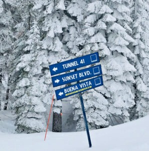
It’s hunker-down time in Lake Tahoe, because the region is about to get hit by a powerful storm that’s going to bring heavy snowfall.

The storm is expected to begin Tuesday evening (March 11) and continue with varying degrees through early next week. Considering the low snow totals for the 2024-25 season, Tahoe ski resorts are hoping it will provide the “Miracle March” that has hit the region in previous years.
The National Weather Service has issued a winter storm watch for Tuesday through Thursday with snow accumulations of 2-3 feet at the ski resorts and over a foot at lake level. Also expect winds up to 70 mph, potentially leading to near-whiteout conditions due to blowing snow.
The weather service recommends drivers brace for widespread chain controls and expect nearly impossible travel along Interstate 80 at Donner Pass, Highway 50 at Echo Summit and other major Sierra passes.
ANOTHER MIRACLE MARCH? March has been historically the most prolific snowfall month in the Lake Tahoe region. This year, March has already delivered several storms in its first few weeks totaling more than a foot of fresh powder.
The latest storm system is predicted to bring some of the heaviest snowfall rates this ski season. Although it will likely contain less moisture than previous atmospheric river storms this winter, powdery snow should lead to higher accumulations.

“We are tracking more snow within this system,” said Gigi Giralte, a meteorologist with the weather service’s Reno office. “The last significant storm we had came in multiple waves. This storm is bringing heavier snowfall rates, and we’ve got some larger snowfall totals we’re expecting.”
Because of the fluffier nature of the snow, there may be more volume than any previous storm this season.
“The powder train is just getting started with forecasts calling for a chance of snow nearly every day this week, portending excellent ski conditions for bluebird days to come in Tahoe,” predicts Tahoe spokesperson Jenn Boyd Lemming of Weidinger Public Relations.
SNOWFALL DOWN THIS SEASON: The snowfall is needed. California Department of Water Resources (DWR) conducted its monthly snow survey March 3 at Phillips Station near Sierra-at-Tahoe, with the snowpack measurements statewide at 85 percent of average. The next measurement is tentatively scheduled for April 2.
Seasonal snow totals are down this ski season. To date, Sugar Bowl has the most overall snow totals, reporting 291 inches at its summit, followed by Mt. Rose with 284. Many Tahoe ski resorts have received less than 200 inches this season. Historically, at upper elevations, most Tahoe ski resorts average between 350 to 500 inches a year.
From this week’s storm, Tahoe ski resorts are expecting large impacts at higher elevations, with OpenSnow reporting a potential of 6 to 21 inches of snowfall for Heavenly ski resort and between 18 and 37 inches at both Kirkwood and Sierra-at-Tahoe.
The downside is avalanche concerns. The Sierra Avalanche Center is reporting moderate to considerable avalanche danger in many areas throughout Tahoe later this week.
WEATHER FORECAST: Bryan Allegretto, OpenSnow weather forecaster, says expect lighter rain and snow early Wednesday that turns to heavy snowfall by night, with snow showers continuing into Thursday.
Allegretto predicts a weaker system of snow showers Friday into Friday night, setting up a possible great weekend of skiing and snowboarding in partly sunny weather. Another storm moves through Monday and clears out by Tuesday.
“From my 20 years of experience forecasting for the northern Sierra, there’s a very good reason why I’ve learned to not make detailed snowfall forecasts beyond five days,” Allegretto said. “It’s still too early for snowfall details for Monday. I’ll start those on Thursday (March 13), but right now we look to be closer to 6-18 inches of snow on the mountain at best.”