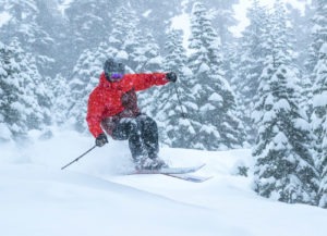
The storm that continued in the Lake Tahoe region Thursday (Jan. 17) could drop 3-6 more feet of snow on Tahoe ski resorts.

A winter storm warning remained in place through Friday. National Weather Service is predicting the storm could drop between 3-6 feet above 7,000 feet before it moves on sometime Friday. According to a KRNV TV in Reno, Wednesday’s blizzard warning was the fourth that’s been issued in the Lake Tahoe region since 2008 and the third since 2017.
Heavy snow continued to fall across the Tahoe region Thursday, dumping more than a foot at the Sierra ski resorts by the afternoon and triggering hazardous driving conditions and an avalanche warning.
Mt. Rose reported the most snow among the Tahoe ski resorts with a whopping 58 inches over a two-day period for skiing and snowboarding.
Squaw Valley reported Thursday morning that it had received 53 inches of snow over a 48-hour period, with 30 inches dropping by Wednesday morning (Jan. 16) and another 23 inches by Thursday morning.
Also getting dumped on was Northstar California, which accumulated 49 inches over the two-day period. Sugar Bowl had 46 inches, tiny Soda Springs ski resort reported 45 inches, Boreal Mountain had 43 inches and Sierra-at-Tahoe reported 41. Eleven Tahoe ski resorts had 34 inches or more.
Despite the snow, Tahoe ski resorts were greatly impacted by poor road conditions and high winds. Mt. Rose, located in Nevada near Incline Village, shut down Thursday due to the Mt. Rose Highway being closed. Diamond Peak ski resort was closed all day due to a power outage in Incline Village.
The upper mountain at Squaw and the ridge-top lifts at neighboring Alpine Meadows did not open Thursday due to high winds. At Squaw, lower lifts – Red Dog, Squaw Creek, KT22, First Venture – were operating in the morning, but by mid-afternoon all the lifts were closed for the day due to high winds. Alpine also shut down its lifts by mid-afternoon.
“It looks like this storm should clear out tomorrow (Friday), and our teams will be working hard to get the maximum possible amount of terrain open for this coming holiday weekend,” said Squaw Valley Alpine Meadows spokesperson Alex Spychalsky.
Although there’s still two weeks left in the month, it’s already been a fantastic January for Squaw-Alpine with nearly 10 feet (117 inches) of snow. The average January delivers 72 inches. Squaw-Alpine has 216 inches for the season.
According to OpenSnow California Snow Forecaster, Bryan Allegretto, Thursday will continue with heavy snow and levels falling to around 4,500 feet by late afternoon, accompanied by ridgetop winds that could gust to 90 mph.

Allegretto is predicting the snow to taper off by Friday morning. The local weather expert is forecasting “weather breaks Friday with scattered showers as a system moves through to the north. Saturday high pressure builds in with nice weather and highs in the 40’s and lighter winds.”
According to Allegretto, another storm moves in Sunday with 4-14 inches possible on the mountains with gusty winds. He predicts a dry pattern starting Monday (Jan. 21) through the final week of January.
SNOW REPORT (48-hour totals)
- Alpine Meadows: 25-13 – 38 inches
- Boreal Mountain: 19-24 – 43 inches
- Diamond Peak: 12-14 – 26 inches
- Heavenly Mountain: 7-12 – 19 inches
- Granlibakken: 18-6 – 24 inches
- Homewood Mountain: 10-24 – 34 inches
- Kirkwood Mountain: 16-18 – 34 inches
- Mt. Rose: 36-22 – 58 inches
- Northstar California: 23-26 – 49 inches
- Sierra-at-Tahoe: 23-19 – 42 inches
- Soda Springs: 19-26 – 45 inches
- Squaw Valley: 30-23 – 53 inches
- Sugar Bowl: 21-25 – 46 inches
- Tahoe Donner: 26-11 – 37 inches