The storm that all Tahoe ski resorts have been waiting for this season arrived over the weekend and is still around a day later, already providing the region with snow totals between 18-30 inches.

Some Tahoe ski resorts received their biggest dump Saturday (Feb. 3) and others who didn’t were besieged with high snow totals Sunday when many resorts had to shut down due to high winds.
Northstar California got a whopping 27 inches Sunday and 30 inches for the weekend, the most among Tahoe ski resorts.
Tahoe Donner had a two-day total of 29 inches and Mt. Rose had 28, including 26 inches on a crazy Sunday. Kirkwood, which received 19 inches Sunday, is reporting 50 inches during the past week. After previous disappointing snow totals, Heavenly got 14 inches Sunday and Diamond Peak had 15.
SEE TAHOE SNOW REPORT BELOW
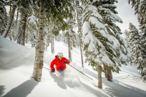
Every Tahoe ski resort had at least 1½ feet of snow from the weekend storm that is continuing into Monday. Sugar Bowl received 17 inches Sunday and 20 overall, making it (along with all Tahoe ski resorts) a definite POW day for skiers and snowboarders.
“February finally delivered a winter storm with the potency that we’ve been hoping for and snow dancing for since December,” a Sugar Bowl blog said Monday. “It’s a bottomless POW day, and the snow is expected to keep falling throughout the day. The (area) schools have rightfully called a snow day and conditions are deep up at the Bowl.”

Sunday delivered plenty of snow. But it was also a scary day at times in the Lake Tahoe region where wind gusts were recorded as high as 162 mph. No wonder so many Tahoe ski resorts had to shut down partially or totally during what could be described as a dangerous afternoon on the slopes.
The National Weather Service (NWS) warns that winter storm warnings will remain in effect in the Tahoe area until approximately 10 a.m. Monday morning. The NWS predicts moderate to heavy snow showers will continue throughout the day with wind gusts continuing. It warns that Monday travel could be hazardous. Chain control is in effect on all major roadways.
WEATHER FORECAST: OpenSnow.com forecaster Bryan Alegretto says snow showers will continue throughout the day on Monday. Highs today should be in the 30s at the base areas and 20s for the upper mountains. The snow levels have dropped back down just below the base and should stay there throughout the day.
The strong winds were prevalent Monday morning, but are forecast to drop through the afternoon, meaning wind holds for some of the upper mountain lifts at several Tahoe ski resorts will eventually drop later in the day. Expect 2-6 inches of snow near the base and 5-9 inches on the upper elevations Monday evening into Tuesday morning.
Scattered snow showers are possible through Friday along with partly sunny skies. The long-term forecast has a drier pattern building in over the weekend into the week of Feb. 12. Storms could return by Feb. 19.

AVALANCHE DANGER: The Sierra Avalanche Center administered a grave warning Monday morning on Instagram, explaining there is high avalanche danger Monday in the Lake Tahoe region.
With fresh snow comes danger, and even though ski patrol teams can bomb and assess conditions, the danger remains, evidenced by January’s unpredictable avalanche at Palisades Tahoe that claimed one life and injured several people in the KT-22 area.
The Avalanche Center says “an intense pulse of snowfall is expected to deposit another foot of new snow this morning. The excessive snow combined with strong winds will fuel ongoing snowpack instability and keep natural avalanches very likely today. Travel in, near, or below avalanche terrain is not recommended.”

TAHOE SNOW REPORT (Feb. 4-5)
- Northstar: 3-27 – 30 inches
- Tahoe Donner: 8-21 – 29 inches
- Mt. Rose: 2-26 – 28 inches
- Kirkwood: 6-19 – 25 inches
- Granlibakken: 2-22 – 24 inches
- Sierra-at-Tahoe: 8-14 – 22 inches
- Palisades Tahoe: 2-18 – 20 inches
- Sugar Bowl: 3-17 – 20 inches
- Homewood: 15-5 – 20 inches
- Heavenly: 6-14 – 20 inches
- Diamond Peak: 3-15 – 18 inches
- Soda Springs: 10-8 – 18 inches
- Boreal: 12-X – NA inches