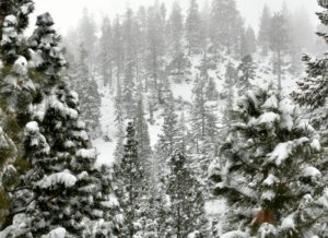
It has definitely been winter the past few days at Lake Tahoe ski resorts, where snow was piling up in feet – not inches!
Heavier snow moved in today and will continue into Wednesday night before tapering off Thursday, according to Bryan Allegretto of Snow Forecaster. Totals could reach 2-3 feet at lake level, and 3-5 feet on the mountains by Thursday.

By noon today, Homewood Mountain had accumulated the most snow with nearly 3 feet (35 inches). Squaw Valley, Alpine Meadows and Mt. Rose were all reporting 30 inches of fresh snow from a storm that began Monday.
Snow Forecaster says there will be a break in the weather Thursday into Friday as some colder air moves in. Sun and gusty winds Friday as the next storm approaches. The snow begins again Saturday morning as a very strong storm moves in. Snow levels will rise to 7,000 feet by Saturday afternoon. Heavy precipitation continues into Monday.
The snow should eventually taper off by Monday night. There’s a possibility of seeing 1-2 feet of snow at lake level and 2-4 feet at 7,000 feet. With temperatures rising, the snow will turn to heavy rain Saturday night through Sunday night and might continue into Monday. According to Snow Forecaster, above 8,000 feet there could be 4-7 feet of snow from the storms.
Snow Totals
- Homewood Mountain: 35″
- Squaw Valley: 30″
- Alpine Meadows: 30″
- Mt. Rose: 30″
- Northstar California: 27″
- Donner Ski Ranch: 24″
- Boreal Mountain: 23″
- Sugar Bowl: 23″
- Heavenly Mountain: 22″
- Sierra-at-Tahoe: 20″
- Tahoe Donner Downhill: 20″
- Diamond Peak: 17″
- Kirkwood Mountain: 14″
- Tahoe Cross-Country: 14″
- Granlibakken: 12″