A much-needed change in the weather will most likely bring a huge boon to Tahoe ski resorts, which have been mostly dormant for the start of the 2021-22 season.

The National Weather Service (NWS) in Reno has issued a winter weather advisory that goes into effect at approximately 8 p.m. Wednesday (Dec. 8) and lasts through perhaps early Thursday afternoon.
The NWS believes snow accumulations could be 6-12 inches above 7,000 feet by Thursday, with half that amount of snow likely accumulating at lake level.
But the bigger news is that much of Northern California and the Tahoe region should get walloped by a much larger storm that should move in Sunday (Dec. 12) and last through Tuesday. There’s also a chance of snow Wednesday and Thursday.
Due to the snow arriving and lower temperatures, Mt. Rose announced it would open Friday and both Heavenly and Kirkwood would begin their season Saturday (see details below).
The hype is growing for the second storm. According to OpenSnow Forecaster Bryan Allegretto, the storm could bring up to 100 inches to Tahoe ski resorts that are mostly devoid of any significant snow right now.
“I wouldn’t bet on that (100 inches) yet, but winter is coming starting Wednesday night with light snow and colder air and then we’ll look at bigger storms for next week,” Allegretto said.
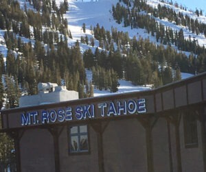
MT. ROSE OPENS FRIDAY: Thanks to its snowmaking and the expected snow this week, Mt. Rose will be running its lifts for the first time Friday (Dec. 10).
It would not be surprising to see multiple Tahoe ski resorts open by the weekend.
“We are going to wait to see the snow on the ground before making any final decisions,” Sugar Bowl spokesperson Jon Slaughter said. We want to open as early as possible, but also need to be realistic about what it will take to go from no snow, to feet of snow instantly.”
Located 25 minutes from Reno and also close to Incline Village in North Lake Tahoe, Mt. Rose has the highest base area elevation (8,260 feet) in the region. That gives the resort a better opportunity to make snow than the Tahoe ski resorts in California.
“Early season operations and a strong commitment to offering superior quality snow surfaces all season long continue to be among our top priorities,” Mt. Rose spokesperson Mike Pierce said.
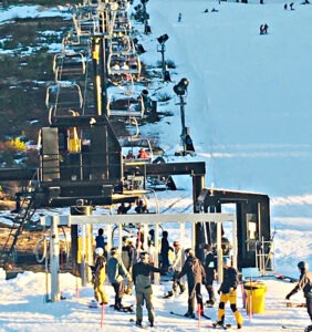
Top-to-bottom skiing and snowboarding will be available at Mt. Rose, starting at 9 a.m. from the Main Lodge. The Northwest Express lift is scheduled to operate, serving intermediate and advanced terrain only.
Open trails will include Upper Northwest Passage down through the Kit Carson Bowl. Note that beginner terrain is not currently available.

For more information about Mt. Rose services, conditions, or to purchase a lift ticket or season pass, visit www.skirose.com.
HEAVENLY TERRAIN: Available trails for skiing and snowboarding on opening day Saturday will be Gunbarrel Express, Aerial Tramway, Patsy’s Chair, and Powderbowl Express. Lifts are open at 8:30 am.
The Tamarack Lodge, Café Blue, Stein’s, and California Lodge will all be open Saturday.
KIRKWOOD TERRAIN: On opening day Saturday, the resort will operate Chair 5 (Solitude) with access to the Outlaw trail. The lift will begin loading at 9 am.
At Kirkwood, the Wall Bar, K Bar, Monte Wolf’s, and the General Store will all be available opening day.
DISMAL LATE FALL WEATHER ENDS: Heading into this week, the Tahoe region’s 14 ski resorts had a combined one legitimate lift open.
Despite running the lone Castle Peak lift that can accommodate all levels of skiers and riders, Boreal Mountain has been drawing pretty decent crowds since opening for the season one day after Thanksgiving.
Both Palisades Tahoe and Soda Springs were also recently open, but lacked sufficient terrain. Palisades had one surface lift that essentially served only beginning skiers and riders, while Soda Springs has been open weekends with only access to some children’s snowplay activities.
MORE STORM DETAILS: Snow levels are expected to start Wednesday around 7,000 to 7.500 feet. The heaviest snow could fall during the early morning hours Thursday into daybreak as the cold front moves through.
The snow should continue Thursday morning before clearing during the afternoon.
According to Allegretto, the second storm will have low pressure and slowly move south down the coast Sunday through Tuesday. Ridgetop wind gusts could increase to 100 mph.
“A deep trough is going to dig south along the West Coast Sunday into Monday,” Allegretto said. “The trough will be bringing down more cold air, which is going to help keep snow levels low with this storm.”