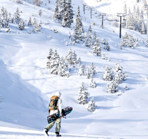
After nearly four weeks of no snow, the cherished white stuff finally showed up Friday at Lake Tahoe ski resorts.
Prior to Friday morning (Jan. 31), it hadn’t snowed in the Tahoe region since Jan. 4. That 27-day run is the fourth-longest dry spell during any winter since 1971. The three other longest snowless periods in Lake Tahoe took place in 2022, 1991 and 1971.
While the rejoicing could be heard at Tahoe ski resorts, the downside was the snow totals were modest by local standards and will likely turn to rain throughout this weekend when rain and high winds are in the forecast.
“Heavy rain and high-elevation snow along with strong winds are predicted for Saturday,” stated OpenSnow forecaster Bryan Allegretto. “A lull with lighter showers takes place Sunday into Monday. Heavy rain and snow returns Monday night through Tuesday, and possibly into Wednesday.”
Allegretto adds that more rain and snow is possible through the end of next week and a colder pattern with storms is possible during the second week of February.
Palisades Tahoe was reporting 9 inches of new snow Saturday morning, the most among Tahoe ski resorts. Sugar Bowl and Mt. Rose both had 8 inches.
SEE TAHOE SNOW REPORT BELOW
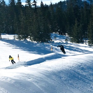
“While January has been on the drier side, the cold (January) temperatures have kept our snow in great shape,” Palisades Tahoe spokesperson Patrick Lacey said earlier this week. “Our grooming team has been working around the clock to create smooth, crisp corduroy for our guests to enjoy carving up. Fingers crossed for a snowstorm to remember.”
Hindering the snow totals have been unseasonable high temperatures in the Lake Tahoe region. At lake level, the low temperatures for Saturday through Monday are expected to be between 34 and 39 degrees. However, starting Tuesday, the lows should be in the 20s.
According to the National Weather Service, snow accumulation predictions for the next four or so days are complicated. A mix of snow and rain are likely for much of the Tahoe basin. Above 8,000 feet elevation, forecasts suggest 20 inches of new snow is likely.
SNOW PACK: The state Department of Water Resources conducted its second snow pack survey this season on Friday morning (Jan. 31). Although the Sierra snowpack was below average for this time of year at 65% of its historical average, the subsequent storms will have the survey spot near Echo Summit looking more substantial by the middle of next week.
The statewide Sierra Nevada snowpack, which provides nearly one-third of California’s water supply, began the year in good shape at 108% of normal during an early January measurement.
“The year began fairly well, better than last year,” said Andrew Schwartz, lead scientist at the UC Berkeley Central Sierra Snow Laboratory, in reference to snowpack levels at the beginning of the year. “We had a nice big atmospheric river in November and another in December that put us above average. Then the tap shut off.”
TAHOE SNOW REPORT (Feb. 1)
- Palisades Tahoe: 9 inches
- Mt. Rose: 8 inches
- Sugar Bowl: 8 inches
- Heavenly: 7 inches
- Boreal: 7 inches
- Kirkwood: 7 inches
- Soda Springs: 5 inches
- Northstar: 5 inches
- Sierra-at-Tahoe: 5 inches
- Tahoe Donner: 5 inches
- Diamond Peak: 5 inches
- Granlibakken: TBA
- Homewood: Closed for the season