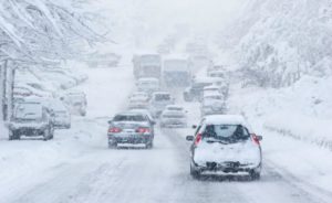
With Lake Tahoe experiencing a winter of epic snow totals approaching 630 inches since November, travel safety remains the most important aspect for a comfortable trip, along with recommendations for planning, common sense and dependable information sources.
Caltrans and Nevada Department of Transportation have done their best to allow access to Lake Tahoe, which currently remains clear and safe despite the record setting snowfall in early 2017.

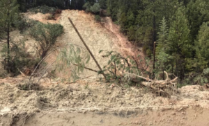
Caltrans is advising motorists to expect delays on U.S. Highway 50 in El Dorado County for emergency repair work in three locations. Work continues this week on US-50 east of Bridal Veil Falls. Traffic is still restricted to one lane in both directions, but is flowing freely. There is fresh snow on the mountain so please be cautious and drive safe.
“The roads have been in great shape as Caltrans District 3 continues to clean up from storms and Emerald Bay has re-opened,” reported the California Highway Patrol. “Make sure to slow down and move over for emergency vehicles and highway workers.”
The highway in Silver Fork between Weber Mill Road and Wildwood Way will be under daytime one-way reversing traffic controls through Saturday for the next two weeks or more in order to have two new culverts installed under the highway and a drainage inlet cleared. Work began Wednesday.
A section of the No. 2 westbound lane in Fresh Pond will closed beginning Thursday in order to stabilize the slope off the highway. This is a four-lane section of Highway 50 and work will be performed behind k-rail. In addition, a section of the highway at Bridal Veil Falls will continue to be reduced to one lane in each direction for the next several months as work continues to stabilize the slope off the westbound side and to build a new 600-foot retaining wall.
Tahoe South Road Conditions
UPDATE CA-50: Caltrans is advising motorists to expect delays on U.S. Highway 50 in El Dorado County for emergency repair work in three locations.
The highway in Silver Fork between Weber Mill Road and Wildwood Way will be under daytime one-way reversing traffic controls Monday through Saturday for the next two weeks or more in order to have two new culverts installed under the highway and a drainage inlet cleared.

A section of the #2 (outside) westbound lane in Fresh Pond will closed beginning Thursday in order to stabilize the slope off the highway. This is a four-lane section of Highway 50 and work will be performed behind k-rail.CA-89: Closed from Emerald Bay State Park to Bliss State Park /Emerald Bay/ (El Dorado Co) – due to snow – motorists are advised to use an alternate route.
- CA-88: No traffic restrictions are reported for this area.
- SR 207: No traffic restrictions are reported for this area.
- SR 431: No traffic restrictions are reported for this area.
North Lake Tahoe Road Conditions
- I-80: No traffic restrictions are reported for this area.
- CA-89: No traffic restrictions are reported for this area.
- CA-267: No traffic restrictions are reported for this area.
- CA-16 E: Closed at Rumsey Canyon / in Rumsey (Yolo County) due to a mudslide. Motorists are advised to use an alternate route.
- CA-49: 1-way controlled traffic from 5 miles north to 5.2 miles north of Nevada City (Nevada County) due to a slide. 1-way controlled traffic from Yuba Pass Summit to Sattley (Sierra County) due to flood damage repairs
- SR 431: No traffic restrictions are reported for this area.
Current Conditions / Forecast
Tahoe South does not expect precipitation until Saturday morning with possible accumulations of five to nine inches of snow. Snow is expected Sunday with possible accumulations of four to eight inches.
North Tahoe does not expect any precipitation until Saturday morning. Five to eight inches of snow is predicted on Saturday; one to three inches on Sunday.
Road Resources
When storm cycles are present, travelers are encouraged to gather as much information as possible before departing. Transportation and law enforcement authorities recommend waiting until a storm passes through before hitting the road. Motorists can check conditions with Caltrans www.dot.ca.gov and Nevada Department of Transportation http://nvroads.com. For real-time traffic information and to map your location, the QuickMap App from CalTrans is available for download. Keep in mind that GPS and maps applications on mobile devices may not be updated so monitor updates directly from the source.