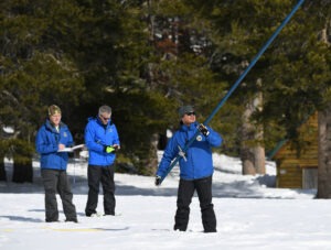
In terms of snowpack in the Lake Tahoe region, the totals as of Wednesday (Feb. 1) are at least two months ahead of the average schedule.

The California snowpack is more than double the seasonal average after receiving a significant boost from one of the wettest three-week periods on record (mid-December to early January), Department of Water Resources (DWR) officials said Wednesday.
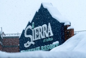
More than 85 inches of snow was measured at Phillips Station, located at the entrance road to Sierra-at-Tahoe ski resort off Highway 50. The total nearly doubled the average for this time of year and is well above the average for April 1. The statewide average is calculated at 33.7 inches or 205% of average for this date. Water officials say April 1 is when the snowpack typically peaks.
The stored water content is ahead of the memorable 1982-83 winter that was the wettest in more than 40 years. Similar readings were measured throughout the Sierra. The central and northern Sierra regions were at 203% and 171%, respectively. A series of January storms has left many of the state’s reservoirs in good shape.
The snowpack provides roughly 30% of the state’s water supply. The snow water equivalent measures the amount of water contained in the snowpack and is a key component of DWR’s water supply forecast.
“Our snowpack is off to an incredible start and it’s exactly what California needs to really help break from our ongoing drought,” said Sean de Guzman, the snow surveys and water supply forecasting manager for DWR.
The snow totals reflect the current season totals for Tahoe ski resorts. By Jan. 26, Tahoe ski resorts owned six of the top-10 snow totals in the United States for the 2022-23 season.

Heading into this week, Sierra-at-Tahoe had the sixth highest snow total in the U.S. with 372 inches. The South Lake Tahoe ski resort was followed by Kirkwood (376), Palisades Tahoe (366), Sugar Bowl (355). Mt. Rose and Northstar shared the 10th slot with 336 inches.
The extremely wet, roughly three-week period that began prior to the Christmas holidays was a welcome sight following what was the driest three-year period on record in California and also one of the hottest heat waves ever for September.
However, there are still two months left in California’s wet season, so state officials are extremely cautious about declaring an end to the drought. A solid start to last year’s winter was followed by the three driest months on record.
“California has always experienced some degree of swings between wet and dry, but the past few months have demonstrated how much more extreme those swings are becoming,” said DWR Director Karla Nemeth. “California is preparing for more intense and dangerous climate swings by bolstering both drought and flood preparation. While today’s results are good news for water supplies, we know from experience how quickly snowpack can disappear if dry conditions return in the months ahead.”
DWR’s electronic readings came from 130 snow sensors placed throughout the state. The Sierra snowpack is often referred to as California’s “frozen reservoir.”
“Large snow totals like today are a welcome sight, but also present new challenges for water managers because they walk the fine line between water supply and flood control,” de Guzman said. “As we move into the snowmelt season in the spring, water managers will work to manage flood risk and optimize the snowpack’s water supply benefits during peak demands in the summer.”
The next survey is tentatively scheduled for March 1.